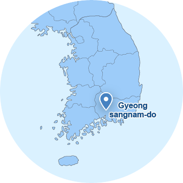
Location
| Location | Bearing | Point of pole between longitude and latitude | Length | |
|---|---|---|---|---|
| Place name | Point of pole | |||
| 1, Sanencheong-ro, Sancheong-eup, Sancheong-gun, Gyeongsangnam-do, Korea | East end | San 28, Hwahyeon-ri, Saengbiryang-myeon, Sancheong-gun, Gyeongsangnam-do, Korea | North latitude 35' 20" and east longitude 128' 07" | 38.8km from east to west |
| West end | 217-573, Seseok-gil, Sicheon-myeon, Sancheong-gun, Gyeongsangnam-do, Korea | North latitude 35' 19" and east longitude 127' 41" | ||
| South end | 366, Bancheon-ro, Sicheon-myeon, Sancheong-gun, Gyeongsangnam-do, Korea | North latitude 35' 13" and east longitude 127' 46" | 40.3km from north to south | |
| North end | San 134, Hyangyang-ri, Saengcho-myeon, Sancheong-gun, Gyeongsangnam-do, Korea | North latitude 35' 34"and east longitude 127' 52" | ||
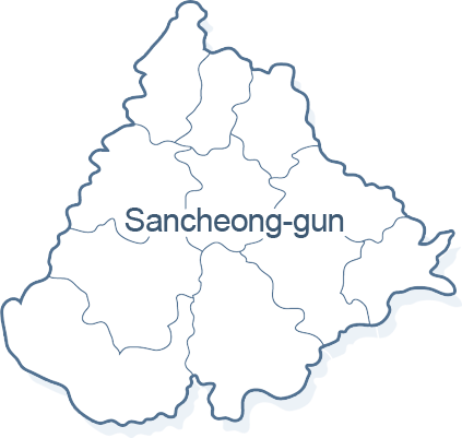
Sancheong-gun is located in the northwest region of Gyeongsangnam-do.
Its eastern part is located next to Hapcheon-gun and Uiryeong-gun, its western part is located next to Hamyang-gun and Hadong-gun, its southern part is located next to Jinju-si, and its northern part is located next to Geochang-gun. The size of Sancheong-gun is 38.8km long from east to west and 40.3km long from north to south. Its surroundings are mostly rugged ridges. Particularly, its western part has the Jiri Mountain Range running north and south from Cheonwangbong Peak, which forms the boundary against Hadong-gun and Hamyang-gun. A divide between Sancheong-gun and Hapcheon-gun is formed by Hwangmaesan Mountain, which is a local peak of Baegunsan Mountain.
Gyeonghogang River, flowing through north and south from Hamyang to the central part, joins with Yangcheongang River, which originates in Hwangmaesan Mountain, in Danseong-myeon and forms Namgang River together with Deokcheongang River. The valleys of these three rivers are fit for agriculture as the surface of these river valleys is fairly flat. It is easy to irrigate them and their soil is rich but unfortunately, they have small plains.
The expressway between Jinju and Daejeon opened in 2001, which made Sancheong-gun more accessible. The National Road 3 between Namhae - Chosanseon, the National Road 20 between Sicheon - Gyeongjuseon, and the National Support Provincial Road that became the National Road 59 between Gwangyang-Yangyang in 25 Aug. 2001 go to and from all directions. In addition, the section between Jinju and Sancheong of the National Road 3 has become a four-lane highway and the Saengcho section of the National Road 3 is on construction to make it become a four-lane highway.
There used to be three existing local loads but three county roads additionally became local roads on 20 Nov. 1995. In Goseong-gun, the local road between Hai - Gojeseon goes from Danseong Gwanjeong to Geumseo Jusang, the local road between Seopo - Danseongseon goes from Danseong Dangsan to Danseong Changchon and the local road between Myeongseok - Chahwangseon goes from Sinan Cheonghyeon to Chahwang Singi. The local road between Obu - Daeyangseon goes from Obu Ojeon to Chahwang Jangbak, the local road between Yurim - Seongsanseon goes from Saengcho Eoseo to Saengcho Hyangyang and the local road between Sindeung - Buhangseon goes from Sindeung Dangye to Sindeung Sajeong. The transportation is pretty convenient as the county roads go up to each myeon office.